
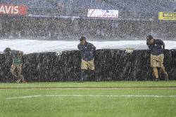
Strong rain storms lashed the East Coast Thursday, delaying flights throughout the region and prompting emergency rescues of motorists trapped in deep water on busy highways from the Philadelphia area to New York City.
In New York, flash flooding briefly closed sections of major roadways across the city just as the evening rush hour approached, and the commuter rail system into suburban Long Island suspended service on one of its busiest lines.
Traffic cameras and social media posts on a highway in the New York City borough of Queens showed motorists at one point standing on the roofs of their stranded vehicles and a tractor trailer nearly fully submerged. The waters eventually receded and traffic slowly resumed, but officials still pleaded with people to say home. Rain was expected to fall through the night.
In Pennsylvania, National Weather Service issued warnings for up to 3 inches of rain in an hour and the downpour produced flooding in the streets of Reading. One video online showed water pouring down a city street, rising halfway up a parked car, and rendering a busy commercial intersection nearly impassable as waters rose into a car’s wheel wells.
In Maryland, emergency responders rescued multiple people from flooded vehicles in communities northeast of Baltimore.
Officials there also preemptively closed roads prone to flooding, shuttered schools and libraries early and opened emergency shelters as more thunderstorms were expected across Maryland into the evening. Flood watches and warnings were issued across the state.
Flash flood warnings were up for parts of New York City, New Jersey and Philadelphia, while states of emergency were declared in New Jersey and New York City, where state workers were sent home early.
Airports in New York, New Jersey and Philadelphia all reported significant flight delays and cancellations.
Tornado warnings in New Jersey came and went with no reports of twisters, though more than 6,000 electricity customers were without power.
Forecasters said the strongest storms were expected later Thursday afternoon and night. The National Weather Service said heavy to excessive rainfall and potentially severe thunderstorms were expected along the Washington-Philadelphia-New York City corridor. Some areas in the southern part of the region could see rainfall rates of 2 inches (5 centimeters) per hour, the service said.
“Stay home this evening unless it’s absolutely necessary for you to go out,” Nassau County Executive Bruce Blakeman told suburban Long Island residents.
The weather service issued flash flood warnings early Thursday afternoon for parts of Berks, Lancaster and York counties in Pennsylvania and parts of Baltimore and Hartford counties in northern Maryland, meaning heavy rain was falling. The service said flooding was possible in small creeks and streams and urban areas, along with highways, streets, underpasses and poor-drainage and low-lying areas.
Flood watches and severe thunderstorm watches were in effect in the region until late Thursday and Friday, with 4 to 6 inches (10 to 15 centimeters) of rain possible in some areas. The weather service posted a severe thunderstorm warning for an area of eastern Pennsylvania between Allentown and Reading, saying 60 mph (97 kph) wind gusts and penny-size hail were possible.
Pennsylvania Gov. Josh Shapiro posted on social media that state emergency management officials were preparing potential response and recovery efforts.
New York City officials warned that heavy rain could flood some streets, parts of the subway and basements. They urged people living in basements to move to higher floors and issued an advisory asking New Yorkers to avoid travel from Thursday afternoon through Friday afternoon.
... Copyright © 1996 - 2025 CoreComm Internet Services, Inc. All Rights Reserved. | View our