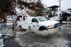
SANTA ROSA, Calif. (AP) — A major storm pummeled Northern California with rain and snow Thursday and threatened to cause flash flooding and rockslides in the latest wave of damaging weather to wash over the West Coast.
The National Weather Service extended a flood watch into Saturday for areas north of San Francisco as the strongest atmospheric river — a large plume of moisture flowing onshore — that California and the Pacific Northwest has seen this season inundated the region. The storm system unleashed winds the night before that left two people dead and hundreds of thousands without power in Washington state.
The weather service office in Sacramento, California, said early Thursday in a social media post that slick roads with ponding water were observed across parts of the valley and foothills, and there were some snow-covered roads in the mountains.
Up to 16 inches of rain (about 41 centimeters) was forecast in Northern California and southwestern Oregon through Friday. By Wednesday evening, some areas in Northern California had experienced heavy rain, including Santa Rosa, which had seen about 5 inches (about 13 centimeters) within 24 hours, according to Marc Chenard, a meteorologist with the National Weather Service.
Dangerous flash flooding, rockslides and debris flows were possible, officials warned. About a dozen small landslides had struck in northern California in the last 24 hours, including one on Highway 281 on Wednesday morning that caused a vehicle crash, said Chenard.
The National Weather Service in the Bay Area warned people that the atmospheric river was focused on the North Bay and to “expect heavy rain to continue tonight, Thursday into Friday. This will result in mudslides, road closures.”
The storm system, which first hit Tuesday, is considered a “ bomb cyclone,” which occurs when a cyclone intensifies rapidly.
A winter storm watch was in place for the northern Sierra Nevada above 3,500 feet (1,066 meters), where 15 inches (38 centimeters) of snow was possible over two days. Wind gusts could top 75 mph (121 kph) in mountain areas, forecasters said.
The storm had already dumped more than a foot of snow along the Cascades by Wednesday evening, according to the National Weather Service. Forecasters warned of blizzard and whiteout conditions and near impossible travel at pass level.
In Washington, there were more than 330,000 power outage reports Thursday morning from strong winds and rain on Tuesday night, according to poweroutage.us.
“We haven’t had a storm like this since January of 2012,” said Mary Kipp, president of Puget Sound Energy, which serves over 1.2 million electric customers in the state. She estimated Thursday that it would be at least a few days for full restoration.
Falling trees struck homes and littered roads across western Washington, killing at least two people. One woman in Lynnwood was killed when a large tree fell on a homeless encampment, while another woman in Bellevue was killed when a tree fell on a home.
More than a dozen schools were closed in the Seattle area Wednesday and some opted to extend those closures through Thursday.
In California, there were reports of about 16,000 power outages as of Thursday morning.
In northern California, only 50 vehicles per hour were allowed through part of northbound Interstate 5 from 10 miles (16 kilometers) north of Redding to 21 miles (34 kilometers) south of Yreka due to snow, according to the state’s Department of Transportation.
Hundreds of flights were delayed and dozens were canceled at the San Francisco International Airport, according to Flight Aware.
The weather service issued a flood watch for parts of southwestern Oregon through Friday evening, while rough winds and seas temporarily halted a ferry route in northwestern Washington between Port Townsend and Coupeville.
___
Golden reported from Seattle.
...


 Copyright © 1996 - 2024 CoreComm Internet Services, Inc. All Rights Reserved. | View our